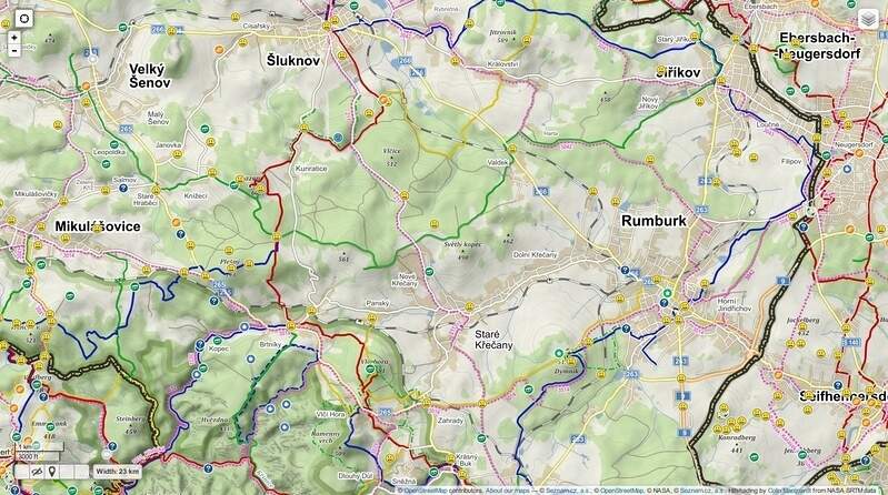
Mapy.cz
[
	{"alt":"Mapy.cz - Základní","tileUrl":"//mapserver.mapy.cz/base-m/{z}-{x}-{y}","minZoom":5,"maxZoom":18,"attribution":"© Seznam.cz, a.s., © OpenStreetMap"},
	{"alt":"Mapy.cz - Turistická","tileUrl":"//mapserver.mapy.cz/turist-m/{z}-{x}-{y}","minZoom":5,"maxZoom":18,"attribution":"© Seznam.cz, a.s., © OpenStreetMap, © NASA"},
	{"alt":"Mapy.cz - Dopravní","tileUrl":"//mapserver.mapy.cz/base-m/{z}-{x}-{y}?s=0.2&dm=Luminosity","minZoom":5,"maxZoom":18,"attribution":"© Seznam.cz, a.s., © OpenStreetMap, © NASA"},
	{"alt":"Mapy.cz - Letní","tileUrl":"//mapserver.mapy.cz/turist_aquatic-m/{z}-{x}-{y}","minZoom":5,"maxZoom":18,"attribution":"© Seznam.cz, a.s., © OpenStreetMap, © NASA"},
	{"alt":"Mapy.cz - Zimní","tileUrl":"//mapserver.mapy.cz/winter-m/{z}-{x}-{y}","minZoom":5,"maxZoom":18,"attribution":"© Seznam.cz, a.s., © OpenStreetMap, © NASA"},
	{"alt":"Mapy.cz - Zeměpisná","tileUrl":"//mapserver.mapy.cz/zemepis-m/{z}-{x}-{y}","minZoom":5,"maxZoom":18,"attribution":"© Seznam.cz, a.s., © OpenStreetMap, © NASA"},
	{"alt":"Mapy.cz - Letecká","tileUrl":"//mapserver.mapy.cz/bing/{z}-{x}-{y}","minZoom":5,"maxZoom":20,"attribution":"3. 7. 2015, © Seznam.cz, a.s., © www.basemap.at, © Microsoft Corporation, © OpenStreetMap"},
	{"alt":"Mapy.cz - Letecká '15","tileUrl":"//mapserver.mapy.cz/ophoto1415-m/{z}-{x}-{y}","minZoom":5,"maxZoom":19,"attribution":"© Seznam.cz, a.s., © EOX IT Services GmbH, © OpenStreetMap"},
	{"alt":"Mapy.cz - Letecká '12","tileUrl":"//mapserver.mapy.cz/ophoto1012-m/{z}-{x}-{y}","minZoom":5,"maxZoom":19,"attribution":"© Seznam.cz, a.s., © GEODIS BRNO,s.r.o."},
	{"alt":"Mapy.cz - Letecká '06","tileUrl":"//mapserver.mapy.cz/ophoto0406-m/{z}-{x}-{y}","minZoom":5,"maxZoom":19,"attribution":"2004 - 2006, © Seznam.cz, a.s., © www.basemap.at, © Microsoft Corporation, © OpenStreetMap"},
	{"alt":"Mapy.cz - Letecká '03","tileUrl":"//mapserver.mapy.cz/ophoto0203-m/{z}-{x}-{y}","minZoom":5,"maxZoom":19,"attribution":"2001 - 2003, © Seznam.cz, a.s., © www.basemap.at, © Microsoft Corporation, © OpenStreetMap"},
	{"alt":"Mapy.cz - Z 19. století","tileUrl":"//mapserver.mapy.cz/army2-m/{z}-{x}-{y}","minZoom":5,"maxZoom":15,"attribution":"© 2nd Military Survey, Austrian State Archive, © MŽP ČR, © UJEP"}
]
překryvy Mapy.cz
[
	{"alt":"Mapy.cz - Popisky","tileUrl":"//mapserver.mapy.cz/hybrid-sparse-m/{z}-{x}-{y}","minZoom":5,"maxZoom":20,"attribution":"© Seznam.cz, a.s.","overlay":true},
	{"alt":"Mapy.cz - Popisky a cesty","tileUrl":"//mapserver.mapy.cz/hybrid-base-m/{z}-{x}-{y}","minZoom":5,"maxZoom":20,"attribution":"© Seznam.cz, a.s.","overlay":true},
	{"alt":"Mapy.cz - Popisky a trasy","tileUrl":"//mapserver.mapy.cz/hybrid-turist-m/{z}-{x}-{y}","minZoom":5,"maxZoom":20,"attribution":"© Seznam.cz, a.s.","overlay":true}
]
ČUZK + překryvy
[
	{"alt":"ČUZK - 1:10000","tileUrl":"http://geoportal.cuzk.cz/WMS_ZM10_PUB/WMService.aspx","crs":"EPSG:4326","layers":"GR_ZM10","format":"image/png","transparent":false,"attribution":"© Český úřad zeměměřický a katastrální","overlay":false,"ignore":false,"minZoom":15,"maxZoom":17},
	{"alt":"ČUZK - Topografická","tileUrl":"http://ags.cuzk.cz/arcgis/services/zmwm/MapServer/WMSServer","crs":"EPSG:3857","layers":"0","format":"image/png","transparent":false,"attribution":"© Český úřad zeměměřický a katastrální","overlay":false,"ignore":false,"minZoom":10,"maxZoom":19},
	{"alt":"ČUZK - Satelitní","tileUrl":"http://ags.cuzk.cz/arcgis/services/ortofoto_wm/MapServer/WMSServer","crs":"EPSG:3857","layers":"0","format":"image/png","transparent":false,"attribution":"© Český úřad zeměměřický a katastrální","overlay":false,"ignore":false,"minZoom":10,"maxZoom":20},
	{"alt":"ČUZK - Jen terén","tileUrl":"http://ags.cuzk.cz/arcgis2/services/dmr5g/ImageServer/WMSServer","crs":"EPSG:4326","layers":"dmr5g:GrayscaleHillshade","format":"image/png","transparent":false,"attribution":"© Český úřad zeměměřický a katastrální","overlay":false,"ignore":false,"minZoom":10,"maxZoom":20},
	{"alt":"ČUZK - Stínování","tileUrl":"http://ags.cuzk.cz/arcgis2/services/dmr5g/ImageServer/WMSServer","crs":"EPSG:4326","layers":"dmr5g:GrayscaleHillshade","format":"image/png","transparent":false,"attribution":"© Český úřad zeměměřický a katastrální","opacity":"0.5","overlay":true,"ignore":false,"minZoom":10,"maxZoom":20}
]
CENIA
[
	{"alt":"CENIA - II. voj. mapování","tileUrl":"http://geoportal.gov.cz/ArcGIS/services/CENIA/cenia_rt_II_vojenske_mapovani/MapServer/WMSServer","crs":"EPSG:4326","layers":"0","format":"image/jpeg","transparent":false,"attribution":"© CENIA","overlay":false,"ignore":false,"minZoom":9,"maxZoom":16},
	{"alt":"CENIA - III. voj. mapování","tileUrl":"http://geoportal.gov.cz/ArcGIS/services/CENIA/cenia_rt_III_vojenske_mapovani/MapServer/WMSServer","crs":"EPSG:4326","layers":"0","format":"image/jpeg","transparent":false,"attribution":"© CENIA","overlay":false,"ignore":false,"minZoom":9,"maxZoom":16},
	{"alt":"CENIA - Vojenská","tileUrl":"http://geoportal.gov.cz/ArcGIS/services/CENIA/cenia_rt_RETM/MapServer/WMSServer","crs":"EPSG:4326","layers":"0,1,2,3,4,5","format":"image/jpeg","transparent":false,"attribution":"© Geografická služba AČR","overlay":false,"minZoom":8,"maxZoom":16}
]


